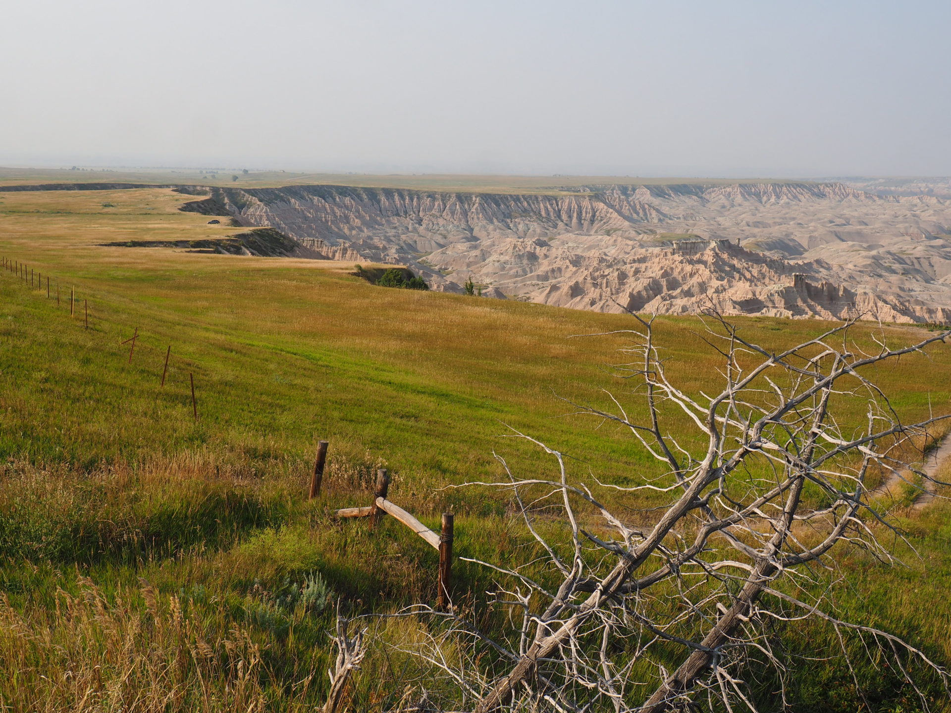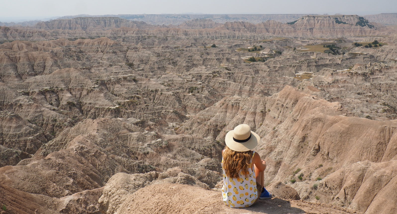
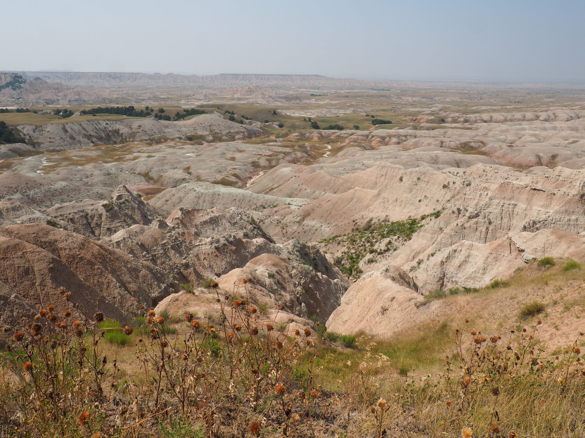
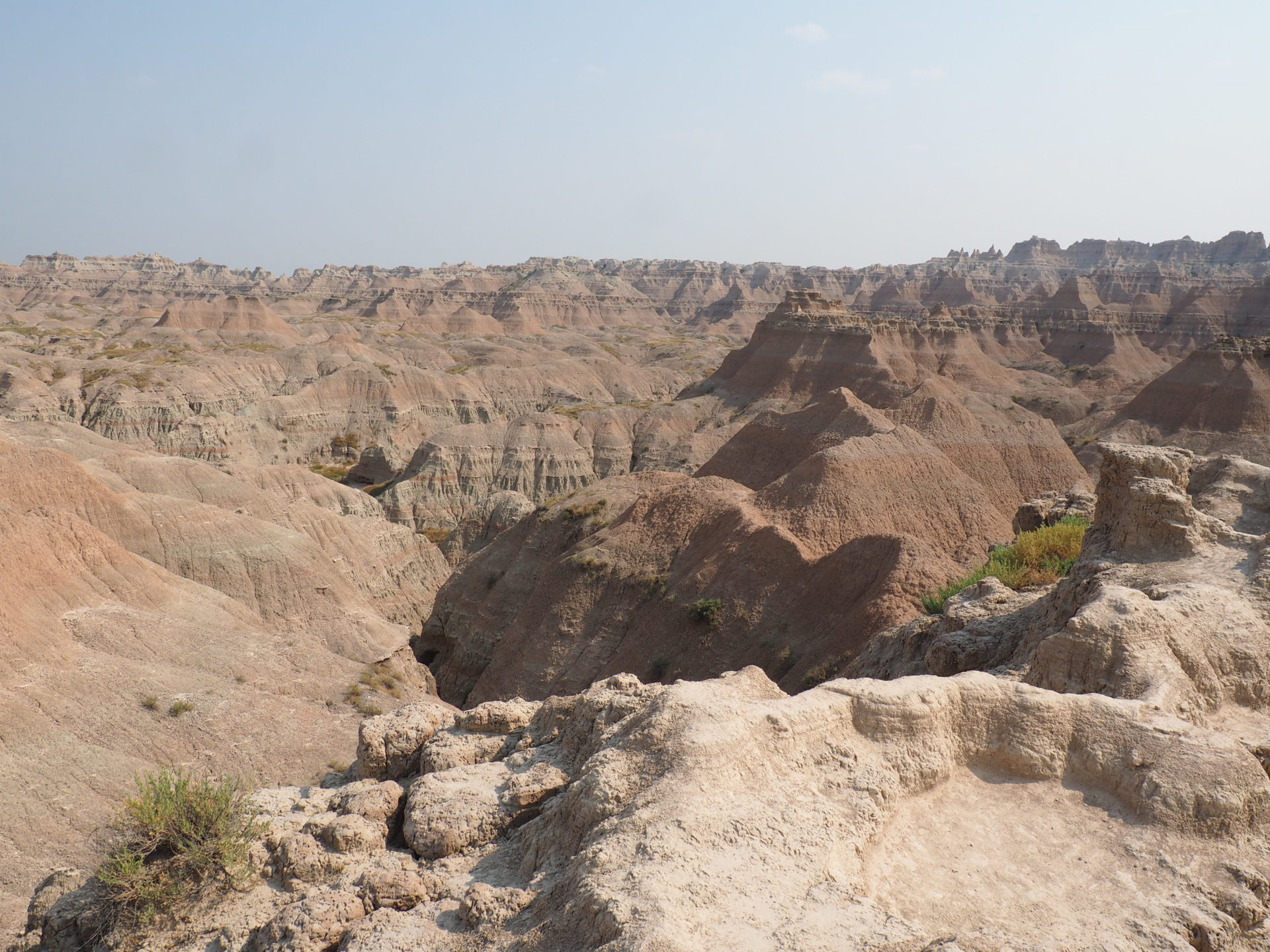
From Colorado we drove for hours and hours and miles and miles up north through the Interstellar-like dusty grain fields of Wyoming. Until – suddenly – the dramatic landscapes of Badlands National Park appeared out of nowhere. The plains just tumble into the canyon. Are we still on earth in here? I wasn’t sure and I’m still wondering if I look back upon those pictures.
As we visited the famous Death Valley in Nevada last year, we couldn’t but compare the two. The resemblance was there for sure: deep canyons, colourful hillsides, towering spires and flat-topped tables can all be found in South-Dakota too.
Located in the middle of the Northern Great Plains the native people have been roaming and hunting these lands – calling them Mako Sica – for ten thousands of years. Or more. Many natives still live near the park.
So let’s go back to the name. Why is it named Badlands? This strange, yet beautiful surface doesn’t seem to deserve such a title. But the first French explorers did think so otherwise. Because it was so difficult to cross the area and because there was so little water to be found for them and those horses, they quickly noted them down as ‘mauvaises terres à traverser’, meaning ‘bad lands to cross’ on their maps.
Steadily the people became aware that this unreal piece of beauty had to be preserved. Badlands was established as a National Park in 1978 and half of it is nowadays co-managed with the Oglala Lakota Nation, the 8th largest American Indian Reservation in the States.
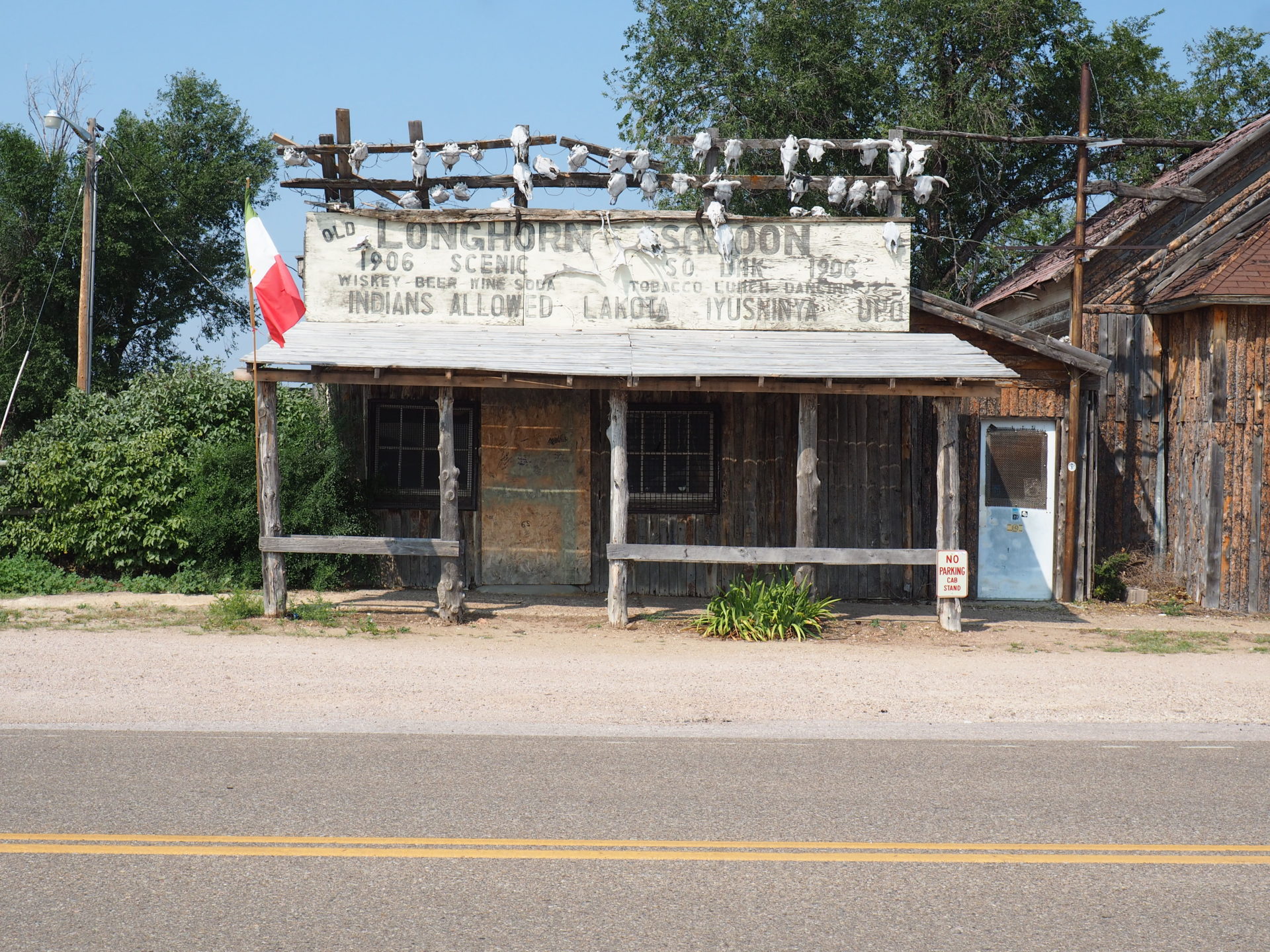
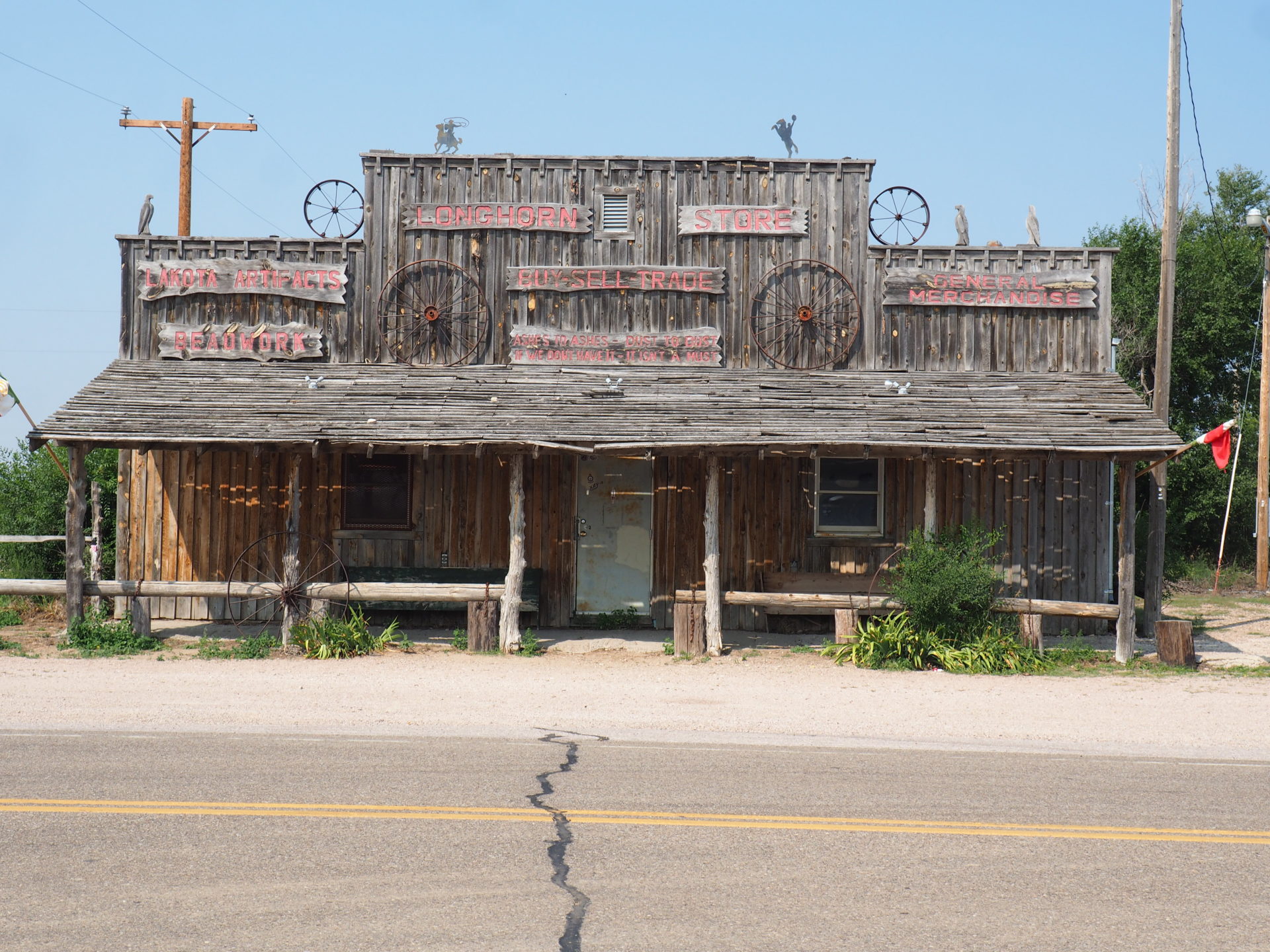
The area still has that wild wild west feeling. Most of the buildings in the direct area around Badlands are in decay and give a glimpse into the past. I’m mean – just look at it. ↓ The village of Longhorn – almost a ghost town – could have been pulled out straight of an old western.
Conveniently enough, it’s fairly easy to explore Badlands. A lot of interesting sights can be seen from the road. Apart from that, there are eight hiking trails (most of them short) that lead to other gorgeous outlooks.
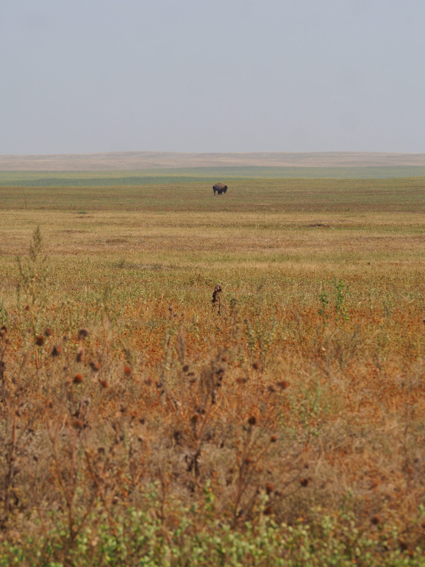
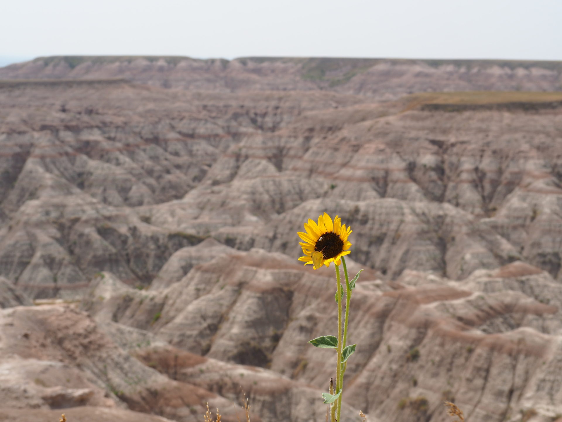
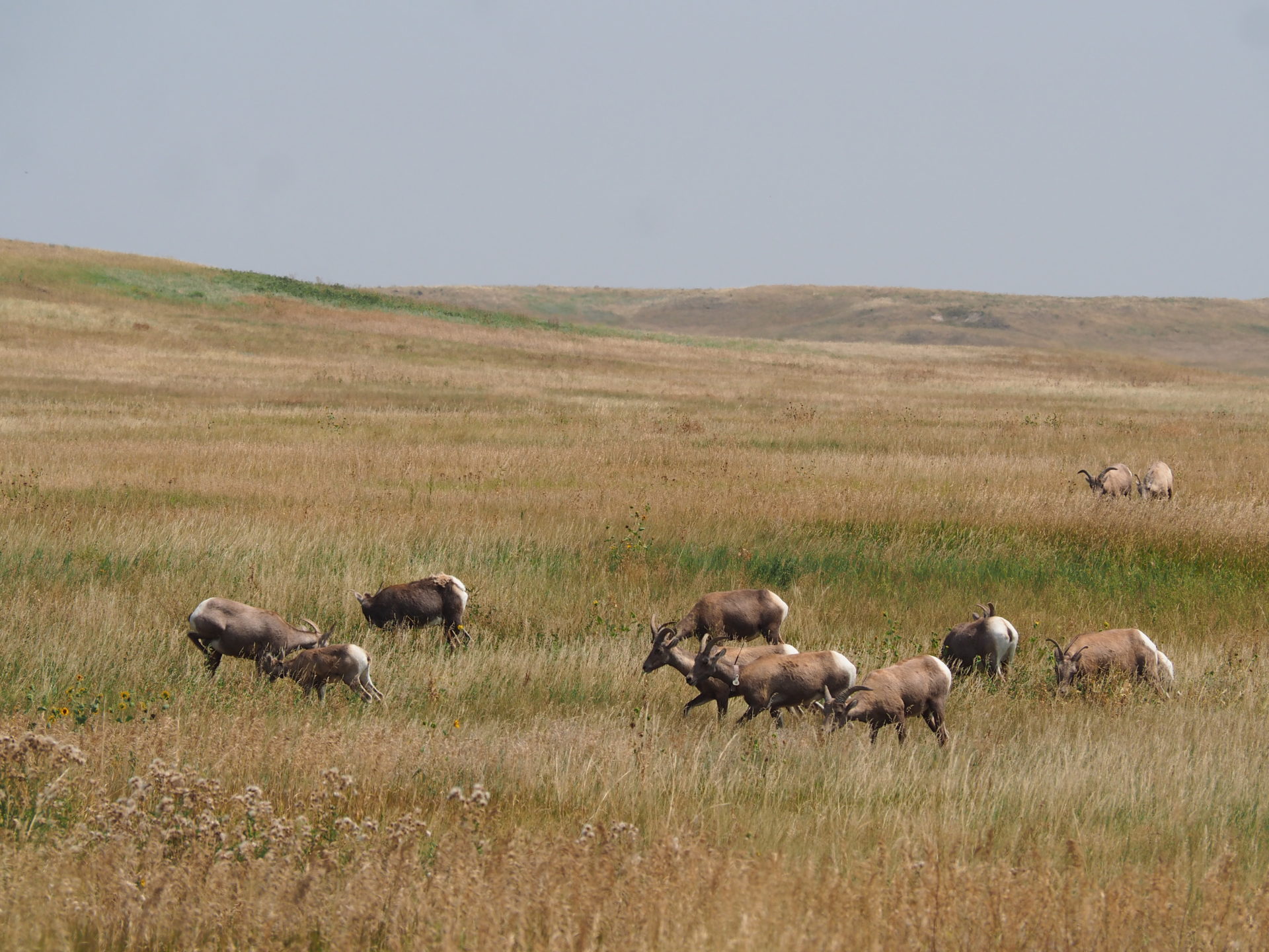
Apart from being focused on the geological wonders in the area, keep an eye out for wildlife too! You wouldn’t think so at first sight, but there’s a lot of life to be spotted out here on the prairies. We encountered quite some bisons, prairie dogs and a herd of bighorn sheep. But if you’re lucky perhaps you’ll see a coyote, fox or porcupine too. Moreover, the rangers successfully reintroduced the black-footed ferrets, one of the world’s rarest mammals.
But I guess those are a bit difficult to spot. Well.. at least the bisons aren’t. ↓
Here’s what I’d recommend you to do if you only have half a day and want to do a little bit of hiking (but not too much) in between:
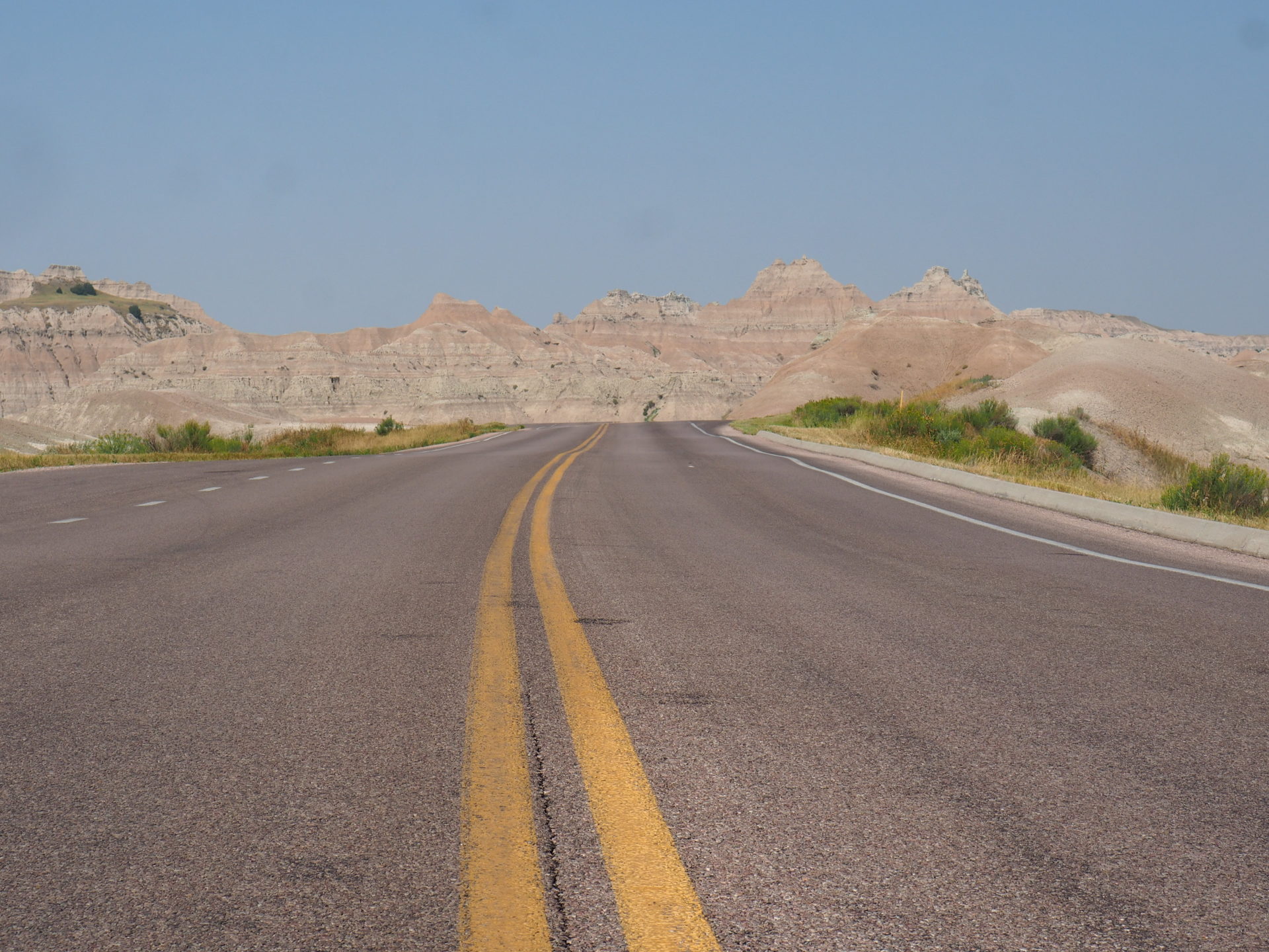
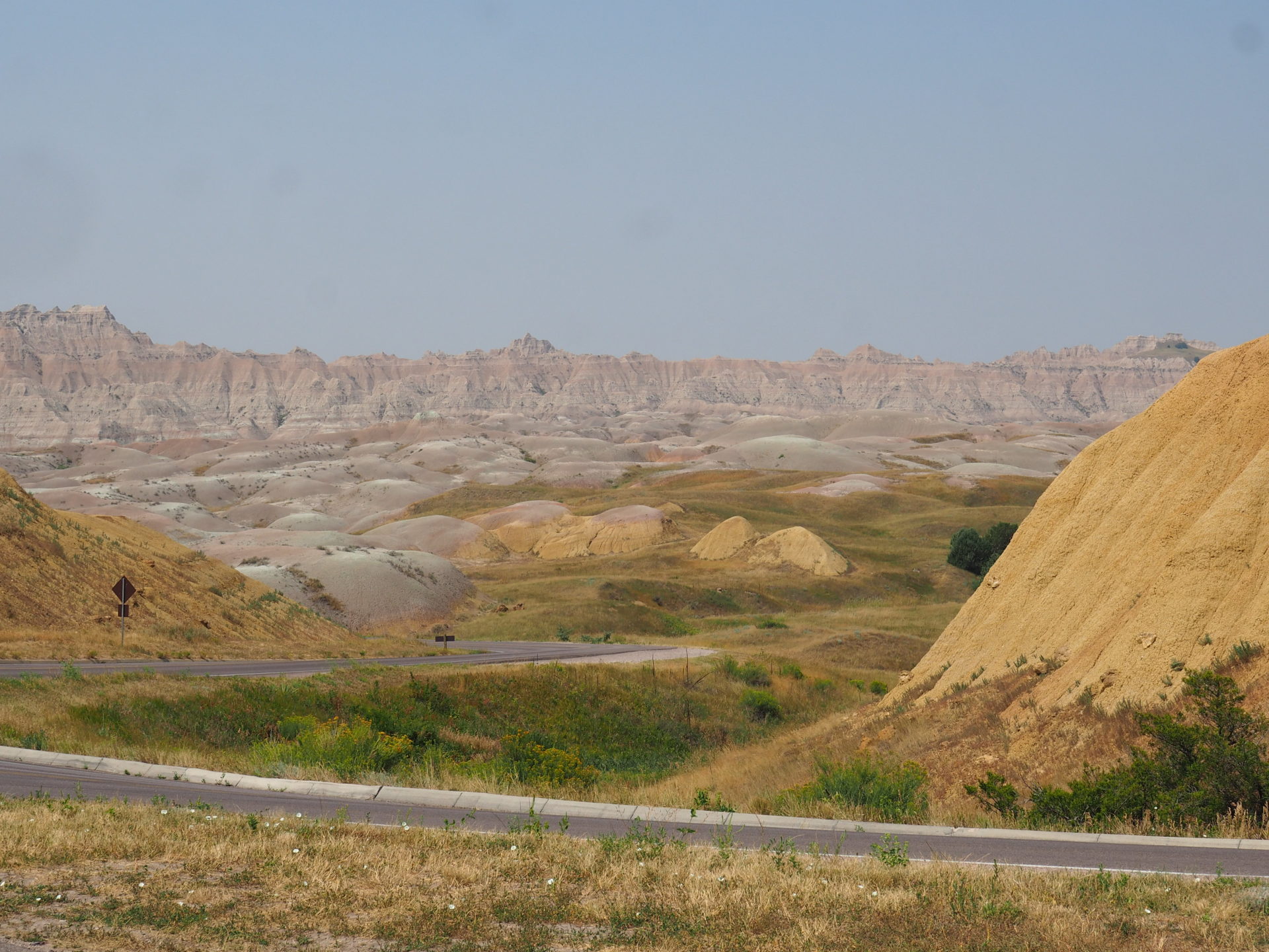
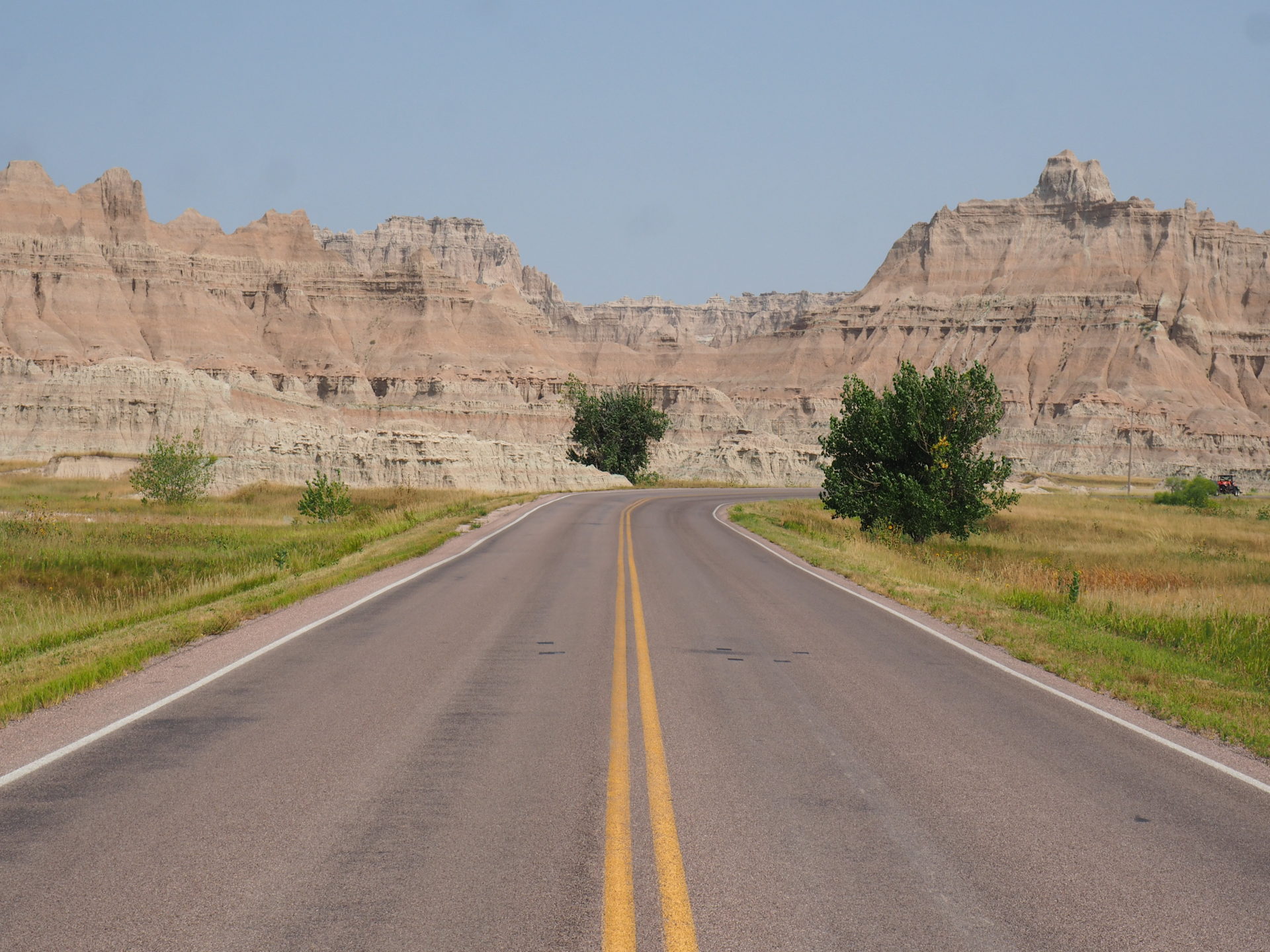
Drive the Highway 240 Loop Road
This road basically ís Badland, or at least leads along the heart of it.
We came in from the west side and drove along the Sage Creek Road towards the Highway 240 Loop Road. This Loop is basically the best way to see it all: there are multiple overlooks and trailheads worth a little break in between.
However, if you’re in a super lazy mood, you don’t even need to step out of the car at all. The views from the road are already spectacular!
But seriously – get out. I guess if you see a pullout, just get out there and stop for a minute. They’ve been designed for a reason. Here’s where to pull off in between for sure:
- Sage Creek Overlook ↓
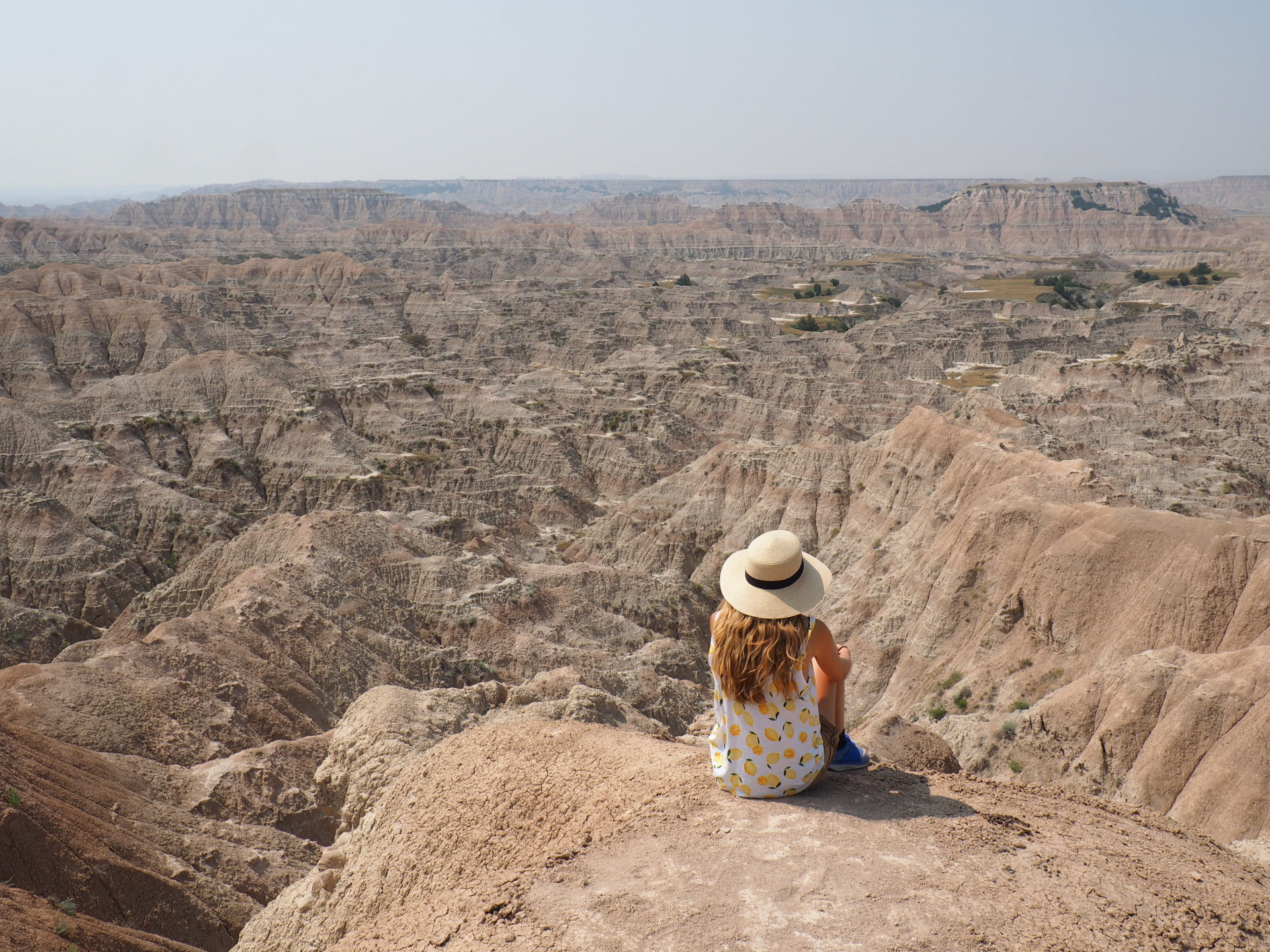
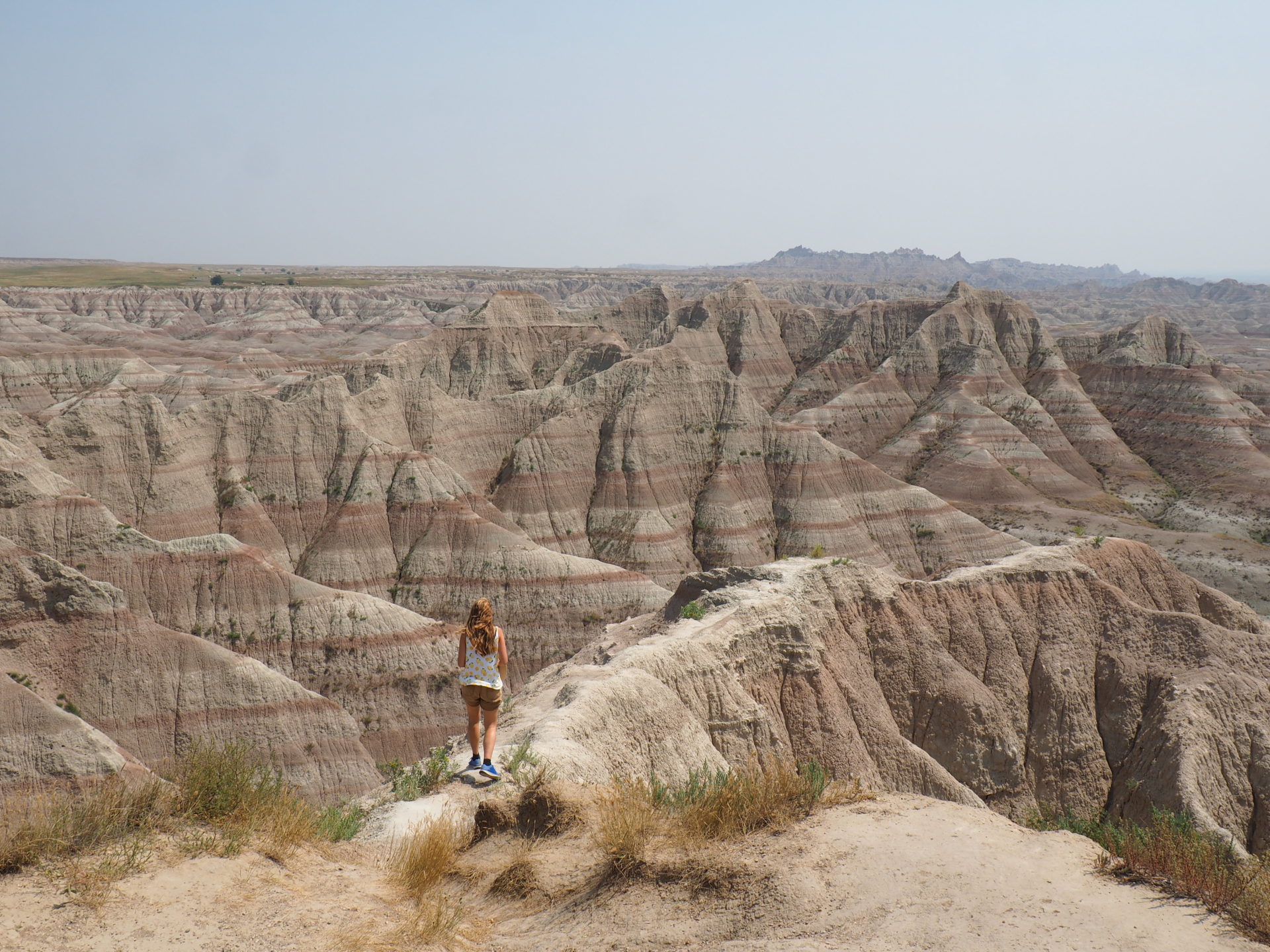
You’re leaving earth by now so take a moment to note that transition. Slowly the landscape becomes more craggy and the green is being replaced by layers of red and yellow. A short hike leads to the bottom of the valley. Watch the scary rattlesnakes though, you really don’t want to step on one of those!
- Pinnacles Overlook ↓
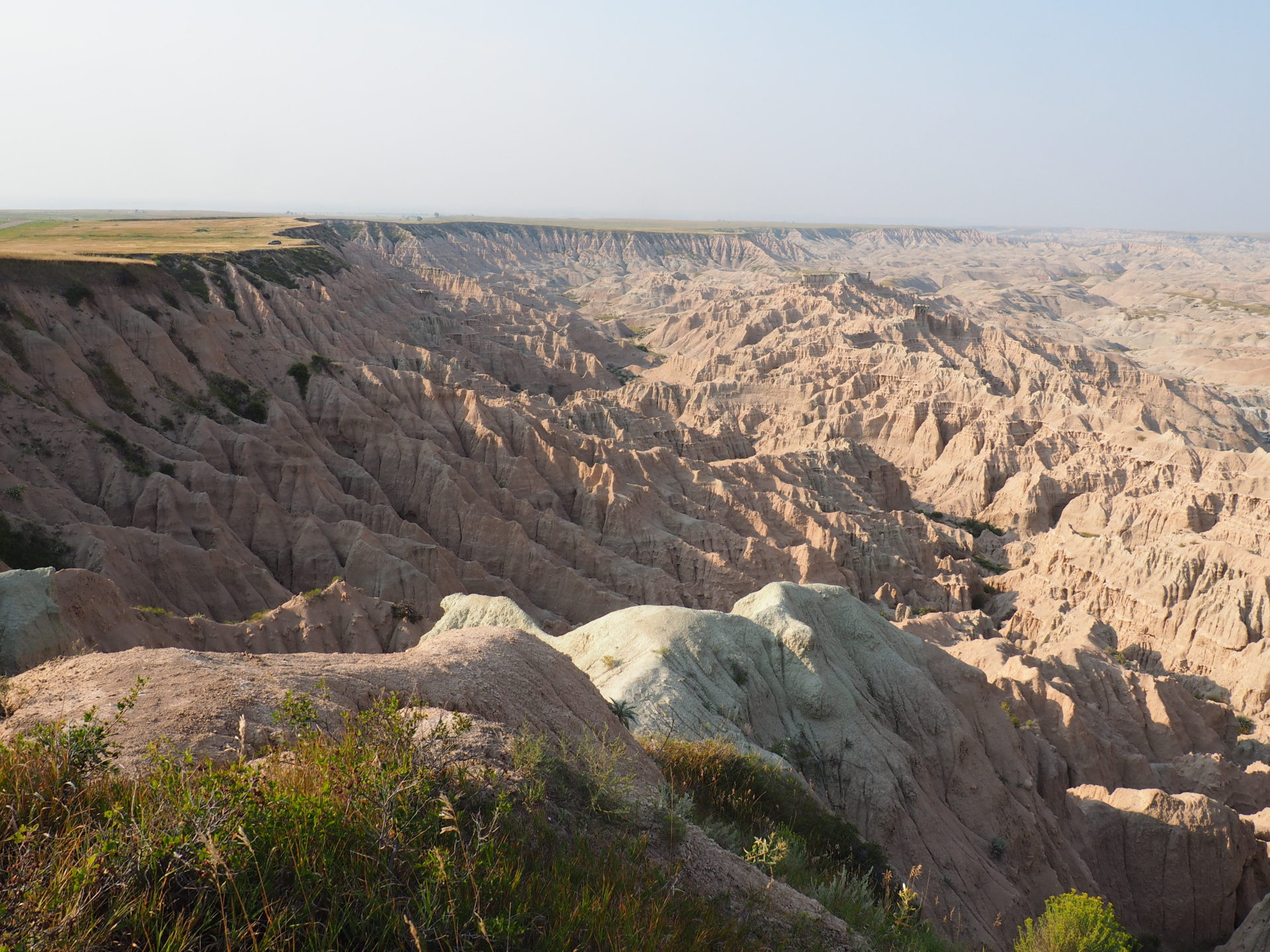
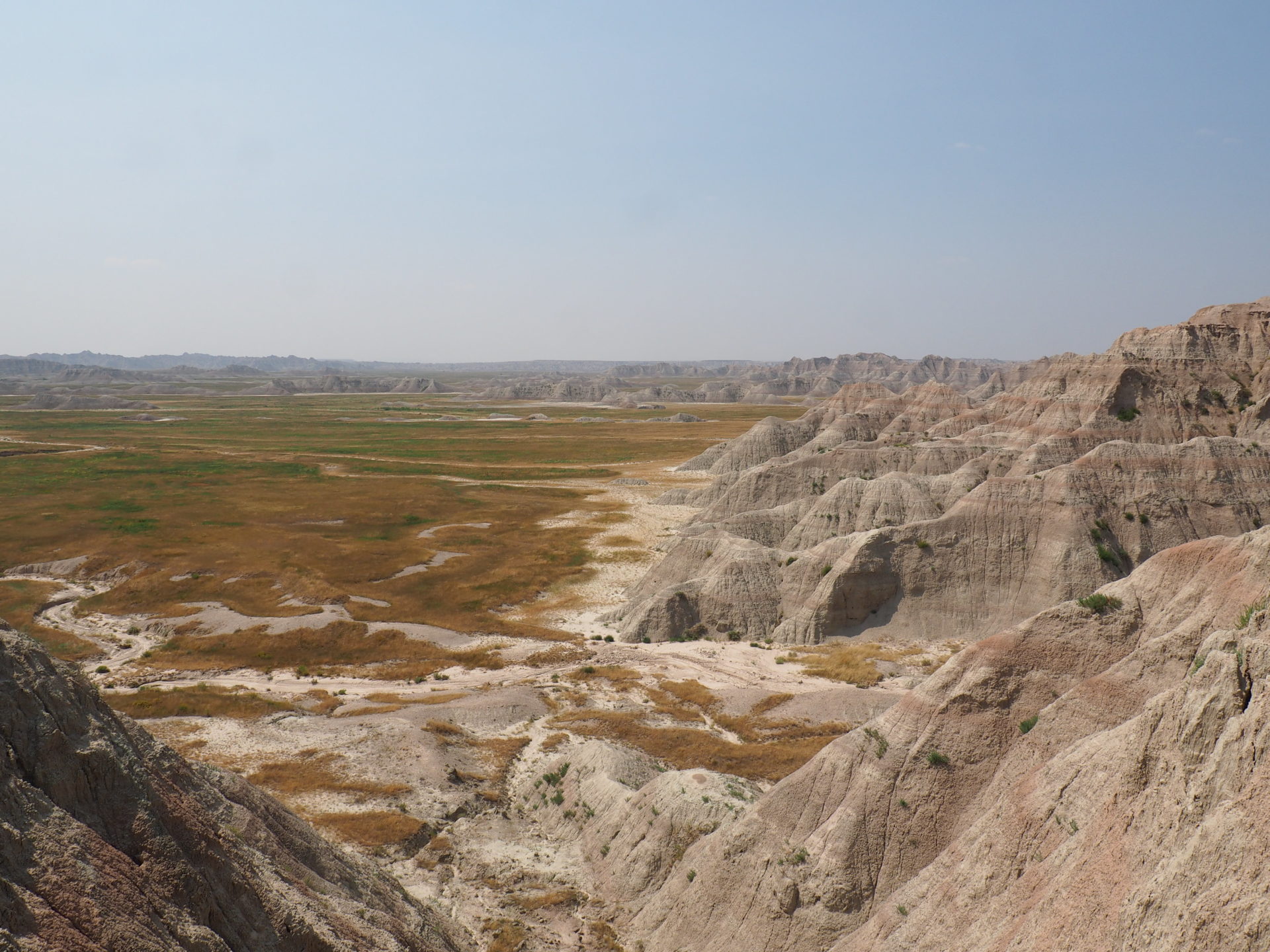
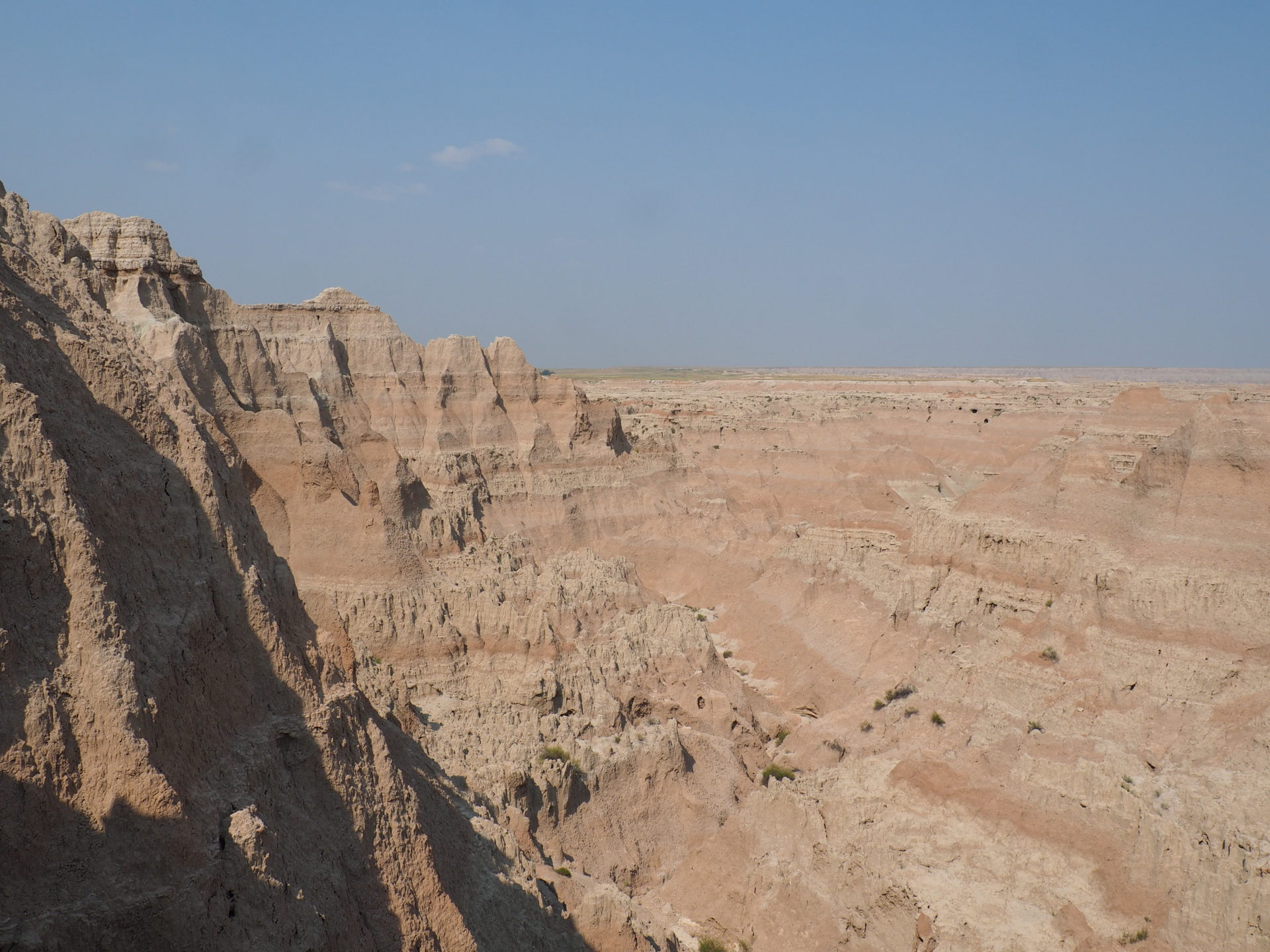
This overlook is quite something, so don’t skimp on it! If you arrive from the upper western corner like we did, Pinnacles Overlook is the first time that the canyon stretches as far as the eye can see.
As it faces west, I think this spot would also make for a neat sunset.
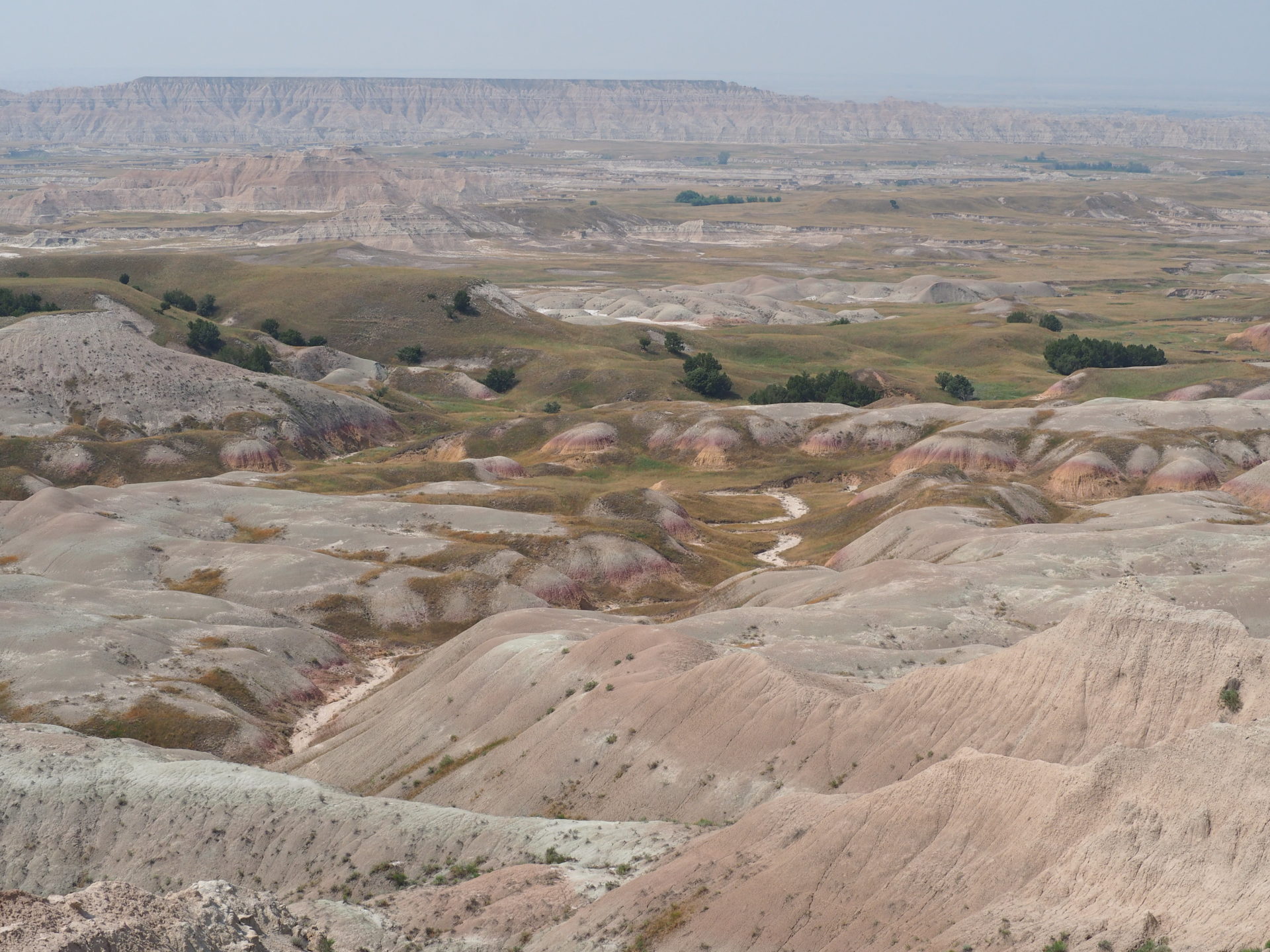
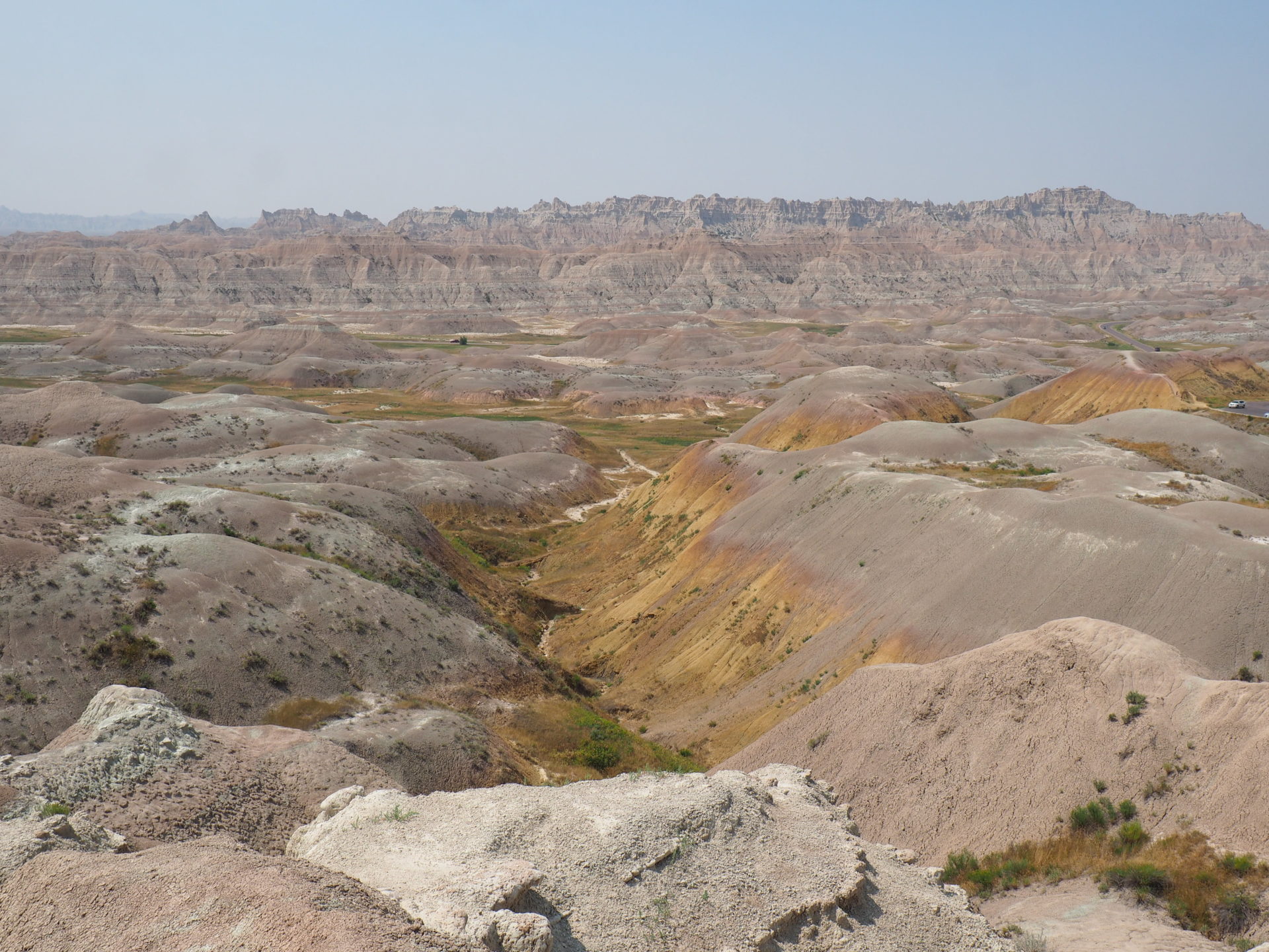
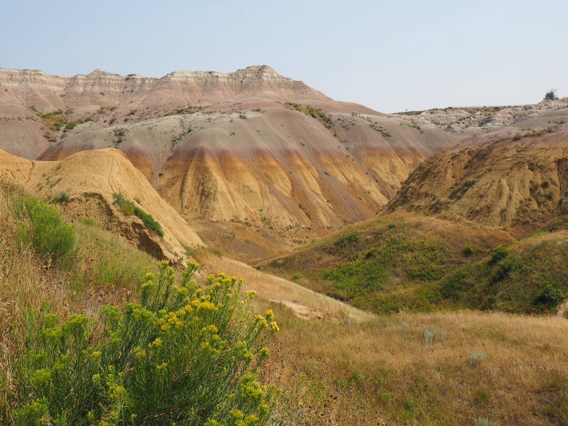
- Yellow Mounds Overlook and Conata Basin Overlook ↓
Layers of contrasting colourful rocks. Who doesn’t like that?
Your camera will at least for sure as it’s a feast for the lens.
- Homestead Overlook ↓
This is an interesting stop if you want to learn more about the human history of this place, as a couple of signs tell about the first homesteaders (what’s in a name) in the 1900s in the White River Valley. Not that many people stop here, so you might have a better change to spot some wildlife in here too.
It’s also a noteworthy pullout because you can see the drastic change from rock formations to prairie in the background very well.
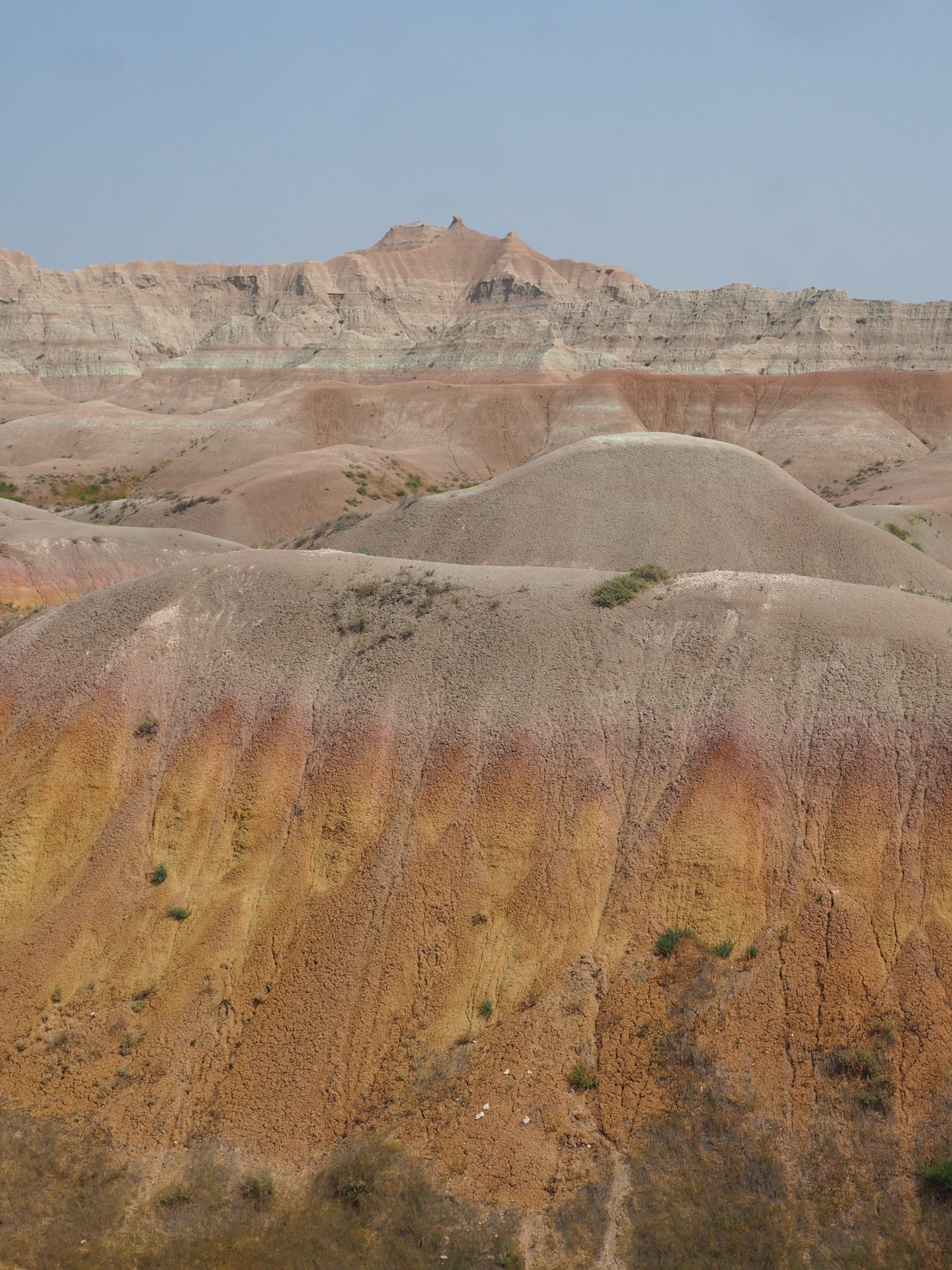
- Burns Basin Overlook ↓
Does this need an explanation? Layers of bacon are waiting for you…
- Bigfoot Pass Overlook ↓
By now you slowly are leaving the high plains. At the end of the road you’ll drive up to the Ben Reifel Visitor Center. Make sure to stop here too, if only for a water refill, to receive extra information on the geological history of the area or to receive that National Park stamp :)!
Hit the trails
- Fossil Exhibit Trail (0.25 miles / 0.4 km roundtrip)
You’ll encounter this easy trail already on the Bandlands Loop Road. Badlands is known for its many fossil findings and scientists have been using this area as an outdoor lab for over 150 years. If you do your best, you might even find a fossil yourself in here! At least that is what the park ranger promised us..
At the time of our visit a ranger at the beginning of the trailhead was explaining all about the fossils found in the area. Pretty fun to here those stories of the now extinct creatures that once roamed the area. But the trail itself also features quite a lot of fossil replicas and explanations about them.
The next three trails are conveniently all in close proximity to one another. You can park the car on the same lot for each hike. All of them are pretty short too, and to be honest I was pretty glad about that during the hot summer days.
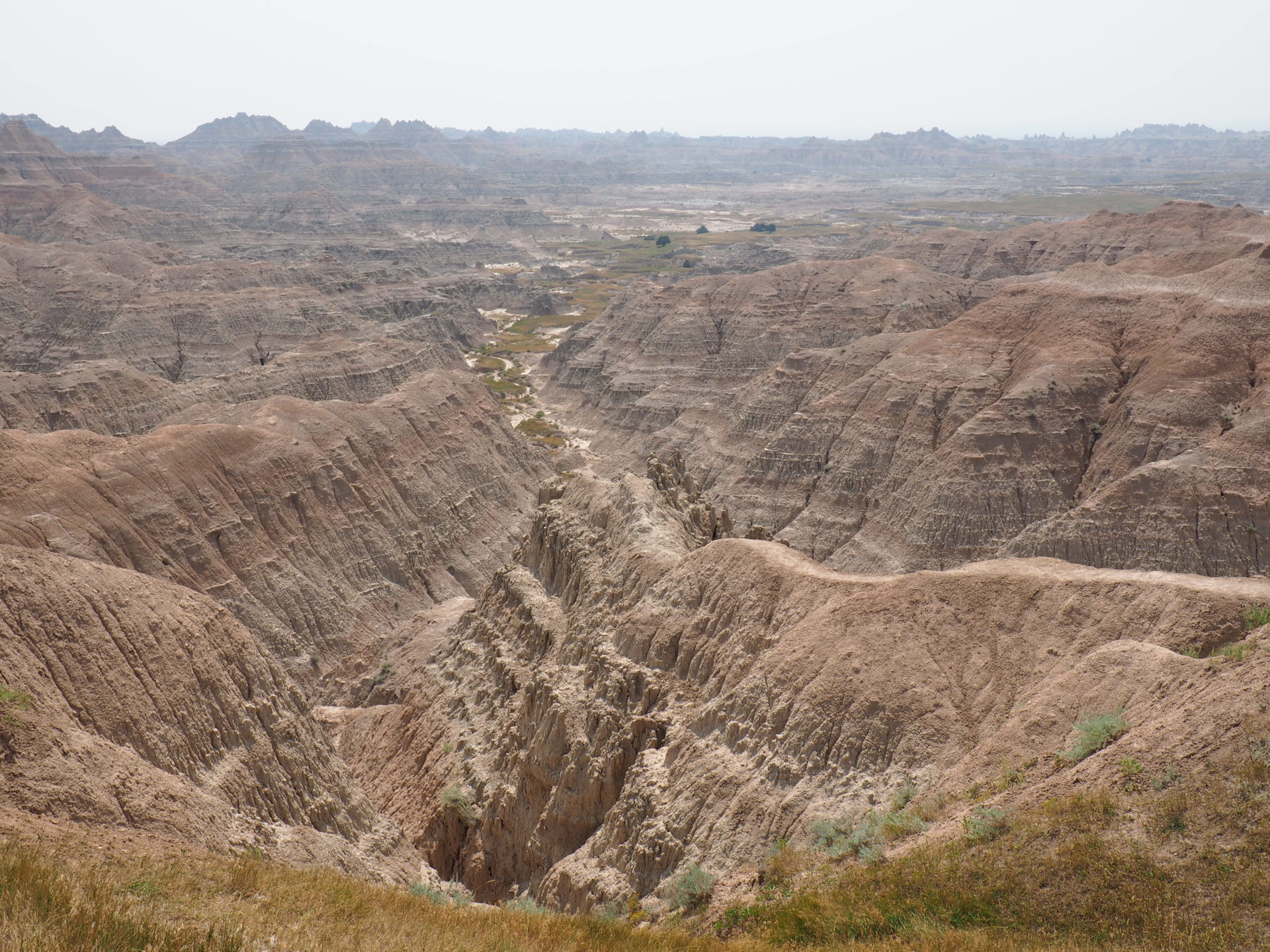
- Door Trail (0.75 miles / 1.2 km roundtrip) ↓
A short trail along a boardwalk leads though a break in the Badlands. The area is known as “The Door”. Travel beyond the boardwalk is possible, yet at your own risk. We walked for another half a mile and encountered the landscapes pictures below.
- Window Trail (0.25 miles / 0.4 km roundtrip)
Okay, now this one is really easy. It’s a mini hike towards a natural window in the Badlands. You basically have see the same area as the previous hike, but from the other side.
- Notch Trail (1.5 miles / 2.4 km roundtrip)
After meandering through a canyon, this trail climbs to “the Notch” with a dramatic view on the White River Valley.
If you’re up for it, the longest trail of Badlands starts at the other side from the parking lot. Castle Trail is 10 miles / 16 km long – again as a roundtrip -, and travels all the way to the Fossil Exhibit Trail to the west.
Red Shirt Table Overlook
Looking for off the beaten path Badlands? Drive to the other side of the park – the western border. Although it’s a long drive, if you’re heading west anyway, this detour is absolutely worth it in my opinion.
You really have the feeling that you’re standing at the edge of the prairie lands. It’s just amazing to see how the green and calms plains just drop into this rugged, colourful open rocky area. As if the earth has been teared open in here and is still dealing with its open wound.
The table, named after Chief Red Shirt, is approximately 10 miles / 16 km long and boasts the highest point in the park. ↓